(Photo/Xinhua)
(Photo/Xinhua)
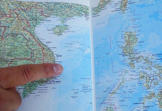
Rand McNally, an American publisher that specializes in maps and other educational materials, labeled Huangyan Island using the Chinese transliteration system of pinyin in a 1994 world atlas, a Chinese American professor has recently pointed out.
Cui Jiaji, a retired professor who used to teach at the New York campus of DeVry University, told the Xinhua News Agency that the 1994 Illustrated Atlas of the World clearly marked "Huangyan Dao" in pinyin on pages 166 and 167.
Cui also noted that the island was placed outside the line of the border of the Philippines. “It is obvious that Huangyan Dao is outside the red border line, and is within Chinese territory,” he said.
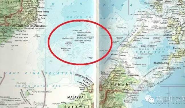
In addition, Xisha and Nansha Islands in the South China Sea were all marked in pinyin, along with Yongshu Reef and Taiping Island. Other land areas on the pages were marked in English, Cui said.
“This has once again proven that China has indisputable rights over the islands in the South China Sea,” Cui said, adding that the edition published in 1994 was revised from the publisher's first edition in 1992, reflecting the U.S. government’s stance on the issue at that time. However, the pinyin "Huangyan Dao" could not be found in the revised 1999 edition of the atlas, Xinhua reported.
In 1994, the United Nations Convention on the Law of the Sea (UNCLOS) came into effect, but the U.S. is not a signatory to UNCLOS, according to Xinhua.

(Photo/Xinhua)
 "Straddling bus" starts production in east China
 Girl goes viral for finger-long toes
 Five made-in-China hi-tech breakthroughs
 HK-Zhuhai-Macao Bridge to open to traffic
 China opens its first combined transport service to Nepal
 Students take stylish bikini graduations photos
 Charming dancing students pose for graduation photos
 Guizhou, Yunnan section of Shanghai-Kunming railway connected
 Naked models transformed into landscapes, birds and even DRAGONS by body painting artist
 Top 20 hottest women in the world in 2014
 Top 10 hardest languages to learn
 10 Chinese female stars with most beautiful faces
 China’s Top 10 Unique Bridges, Highways and Roads
 China's reaction to arbitration depends on provocation
 Past meets present in rich scenery and culture along on the Silk Road
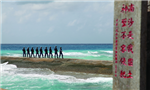 What you need to know about The Hague arbitration, the China-Philippines sea dispute
 The true face of baby photography
Day|Week

